A Photograph
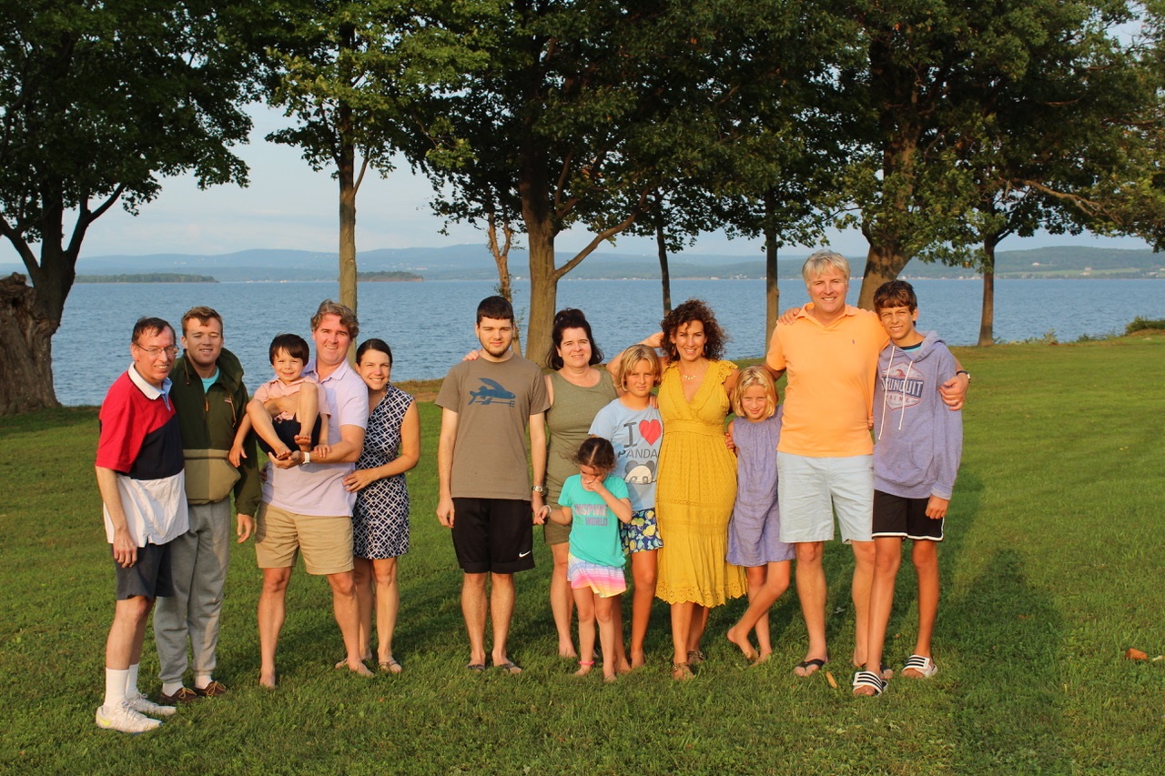
East-northeasterly view of the Green Mountains from Emerald Point on Grand Isle. Peter and Marilyn's family without Peter and Marilyn. August 2018. |
In August 2018, Roger Byrne sent me the photo above of three of our four children, their spouses, and our seven grandchildren at Emerald Point on Grand Isle in Lake Champlain. Marilyn and I could not be there because of Marilyn's health. Marilyn died two years later. Roger died 11 months after Marilyn.
The photo has been the background on my desktop computer ever since I got it. It's a great family photo, but it has piqued my interest in the mountains in the background. Are those the Green Mountains? Would it be possible to identify specific mountains?
Jay Peak?
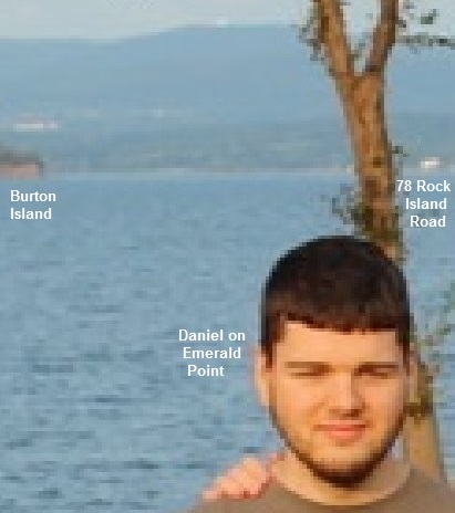
Close-up of August 2018 photo . |
The biggest mountain appears to be the one over Daniel's right shoulder. If you enlarge that area, you get the photo to the right. The green on the left border is Burton Island. The white on the right border is probably 78 Rock Island Road in Georgia, Vermont. If you draw a line on a map from Emerald Point through the middle of Burton Island and 78 Rock Island Road, you run into a mountain called Jay Peak.
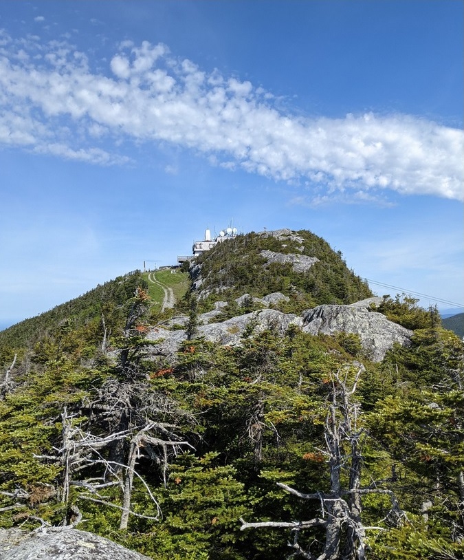
Jay Peak is a mountain located about 7 miles south of the Canada–US border, in Jay and Westfield, Orleans County, Vermont, of which it is the highest point. Most of the mountain is in Jay State Forest. The mountain is named for the town of Jay, Vermont, in which much of the mountain except the peak area itself is located. The town of Jay is in turn named for John Jay, the first Chief Justice of the United States and a local landholder. Jay Peak is part of the northern Green Mountains. The mountain is flanked to the southwest by Big Jay, and to the north by North Jay Peak.
According to Peakbagger Jay Peak is 3,858 feet above sea level.
According to Summit Post, its summit is "rocky and surrounded by stunted trees. Although below treeline, one gets the impression it isn't below that line by much. Views from the mountain are extraordinary."
Jay Peak is 7 miles south of the Canadian border, 16 miles west of Lake Memphremagog, and 38 miles east northeast of Emerald Point on Grand Isle in Lake Champlain.
Some people say there is no way that Jay Peak can be seen from Grand Isle. They say all we are seeing is some minor nearby hills.
The White Dot
But, one more thing. If you look closely at "Jay Peak" in a close-up of the August 2018 photo, you will see what looks like a blurry white dot. A non-close-up of a June 2022 iPad photo is not so blurry. What is that white dot?
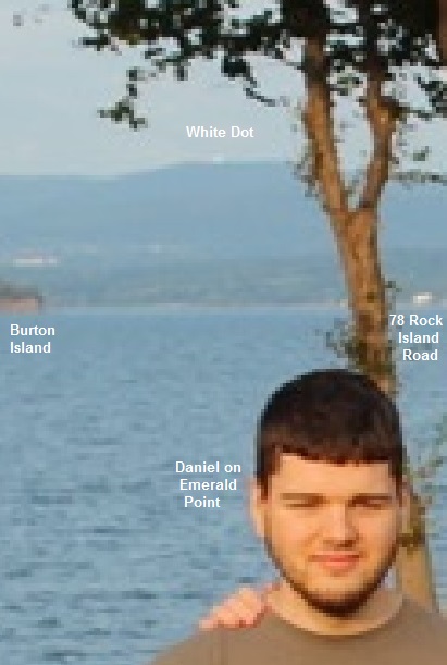
Close-up of August 2018 photo. |
|
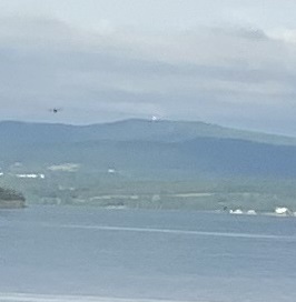
Non-close-up of June 2022 photo, showing clearer white dot. |
|
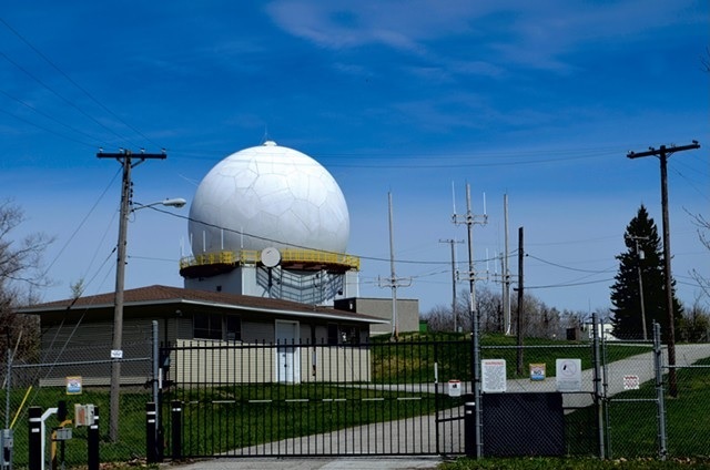
Bellevue Hill
Using binoculars from Emerald Point in August 2022, we noticed a large white sphere. We did a search for white dome near St. Albans What Is That White Dome on a Hill Overlooking St. Albans? by Ken Picard. He says "It's Vermont's most visible remnant of the Cold War era, one that's still in use today, albeit for mostly civilian purposes."
According to Peakbagger Bellevue Hill is 1,320 feet above sea level.
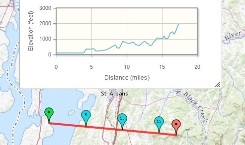
According to Map Pedometer, Bellevue Hill is 10 miles east northeast of Emerald Point on Grand Isle in Lake Champlain.
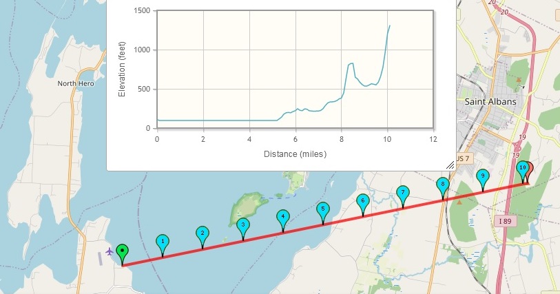
Elevation and distance from Emerald Point on Grand Isle to Bellevue Hill. See: Map Pedometer. |
Bellevue Hill offers unobstructed panoramic views of the Champlain Valley, the Adirondacks and even Montréal on clear days. As far back as 1870, it hosted a lookout tower that was open to the public. At the end of World War II, Bellevue Hill became a site of electronic surveillance.
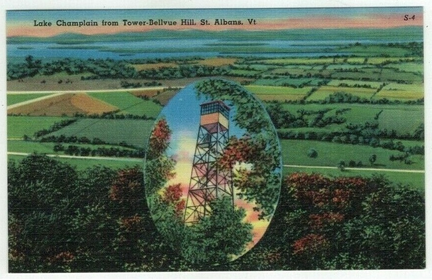
Postcard view of Lake Champlain from the Tower on Bellevue Hill, ca. 1930–1945. The island on the far left is Ball Island. Just above it is Ladd point on Grand Isle. To the right of Ball island is the larger Burton Island. To the right of that is St. Albans Point. In front of the point is St. Albans Bay. The road closer to the water is US 7. The road below it is VT 104. The cross road on the left is Conger Road. See: Boston Public Library. |
Not the Sky Haus on Jay Peak
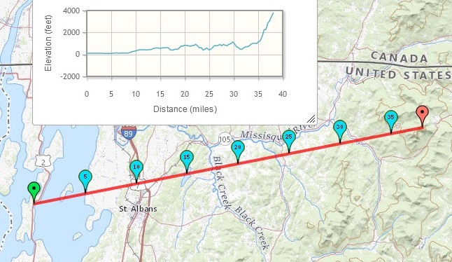
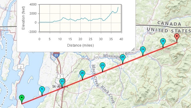
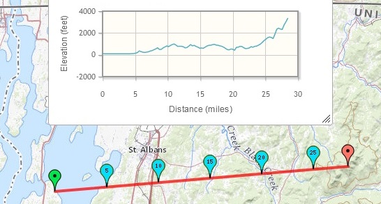
The white dot is not the Sky Haus of Jay Peak Resort. As can be seen on the graph below, Bellvue Hill, 10.1 miles from Emerald Point, practically blocks out Jay Peak at 38.2 miles. This is especially true when you consider the curvature of the earth. See: Earth's Curvature
by David Senesac. The effect at 10 miles is 66 feet. The effect at 38 miles is 954 feet.
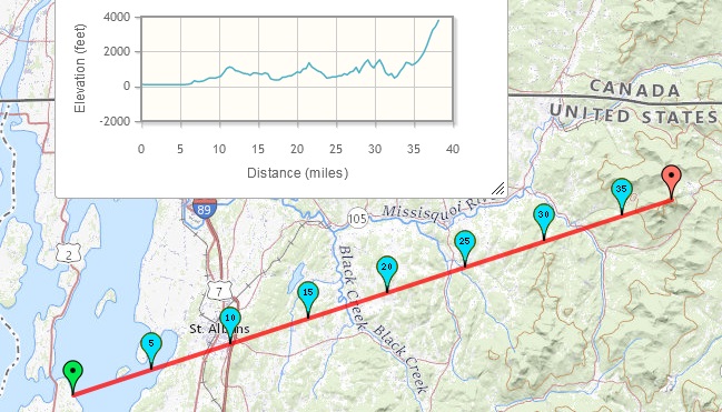
Elevation and distance from Emerald Point on Grand Isle to Jay Peak. See: Map Pedometer. |
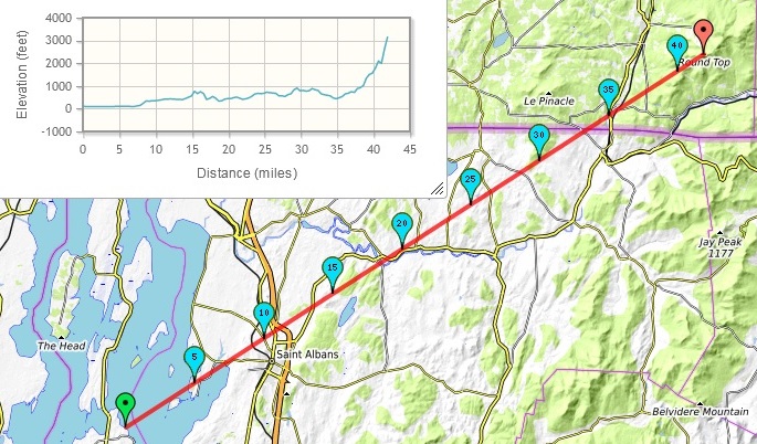
Maybe from Shore Acres
Elevation and distance from Shore Acres on North Hero to Jay Peak. See: Map Pedometer. |
Maybe from North Hero Bar
Elevation and distance from North Hero Bar to Jay Peak. See: Map Pedometer. |
About Jay Peak
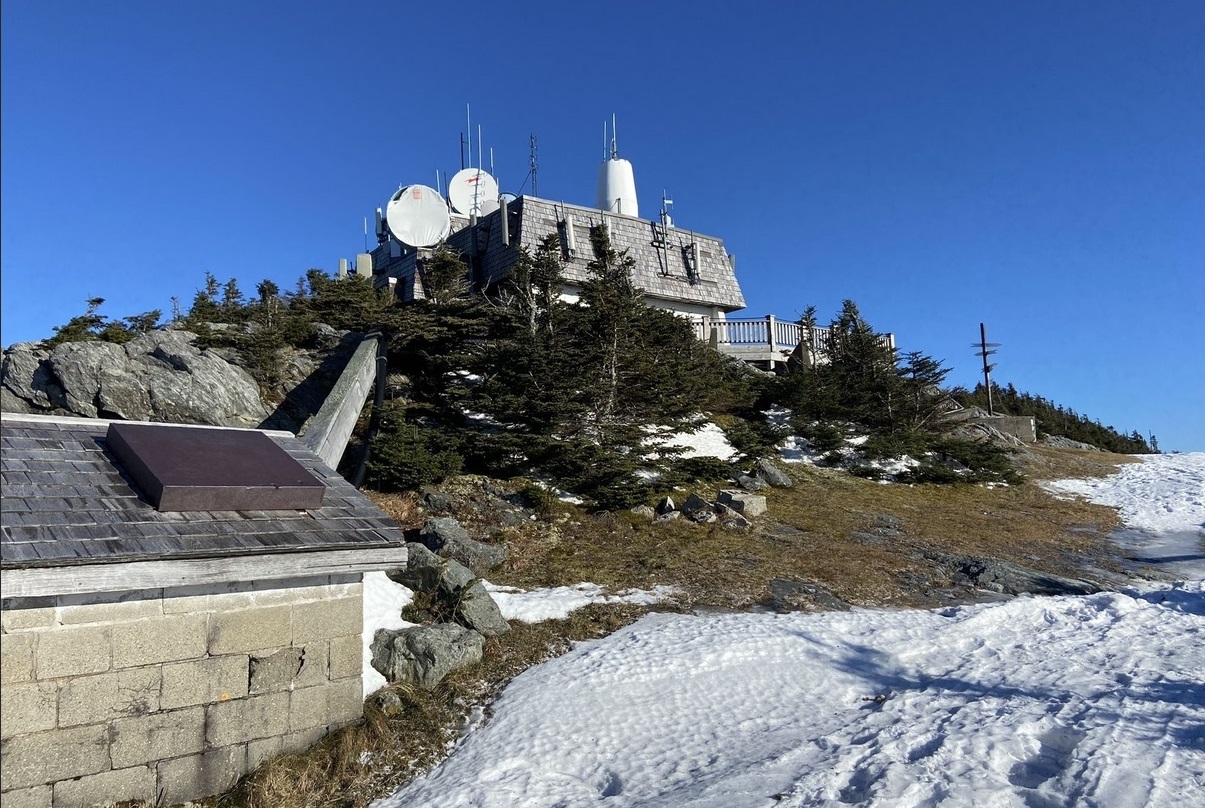
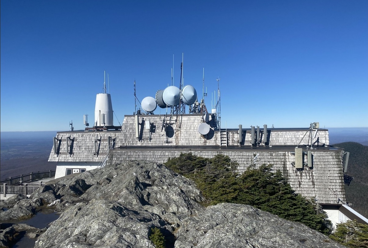
The Sky Haus of Jay Peak Resort, built in 1968, houses the upper terminal of the ski lift and aerial tram on its northeast side and the Sky Haus Deli on its southwest side. It overlooks "scenic views of Vermont, New York, and Canada. Ride the tram up to enjoy all Sky Haus Deli has to offer." The Deli is closed. The aerial tram remains open year round, but it is closed Monday-Wednesday during the summer.
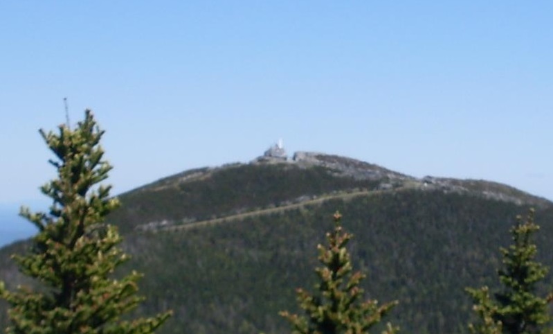
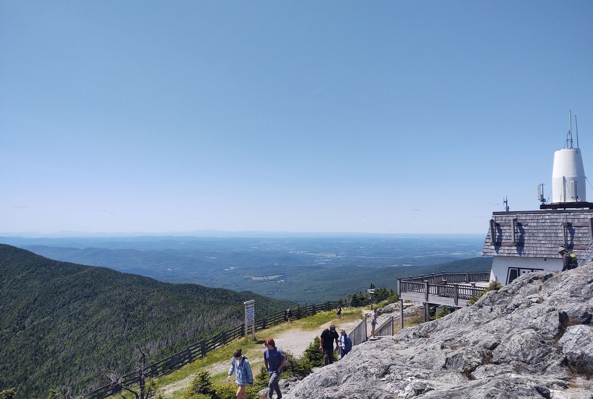
Photo of Jay Peak Sky Haus from Big Jay. Big Jay is 79 feet lower than Jay Peak, and it is one mile southwest of Jay Peak. (Emerald Point is west southwest). October 2008. See Peakbagger. |
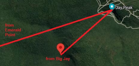
Angle of view from Big Jay compared with Emerald point. |
In 2014, AES Northeast renovated the Sky Haus from an unused, dated lounge space to a deli and dining room. The entire building was renovated, including an "updated energy-efficient building envelope."
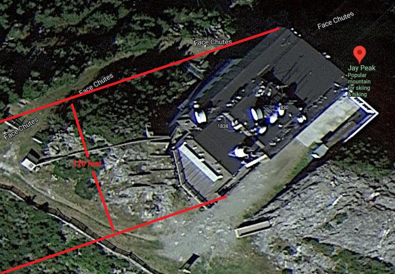
Jay Peak Sky Haus on Google Satellite Maps, July 2022. The two east northeasterly red lines are the approximate angle of the view from Emerald Point. The width of the building view is about 120 feet. |
Much of the building is painted white. The satellite dishes are white. The roof looks whitish in some photos. Following are some photos of the Sky Haus on Jay Peak.
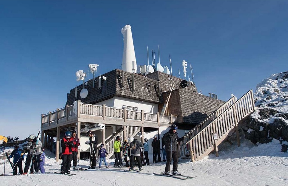
Northerly view of the Sky Haus on Jay Peak. Source: DuBois & King. |
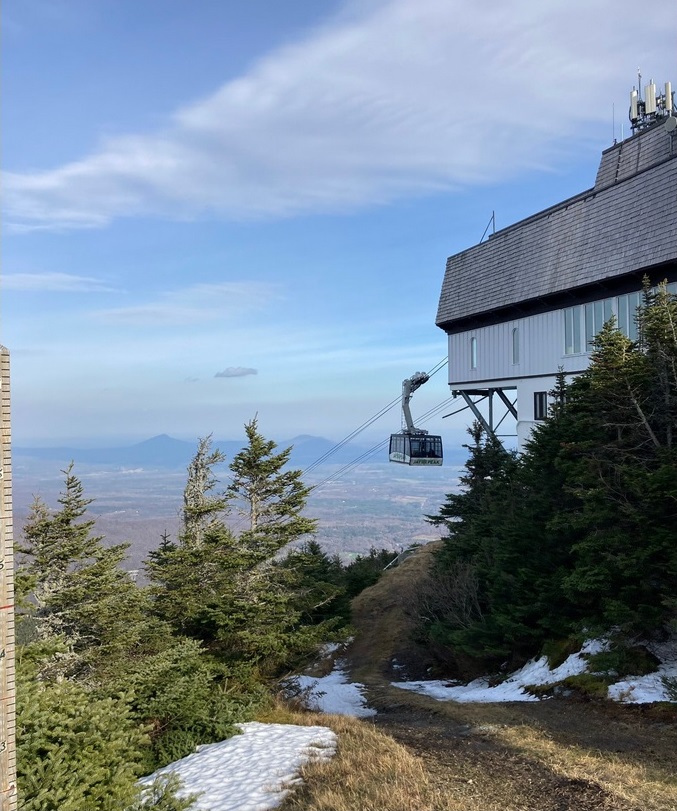
Aerial tram from northwest side of the Sky Haus on Jay Peak. Photo by Elifa F, November 2020. |
Northeasterly view of Jay Peak Sky Haus. Photo by Marie-2008 Leroux, December 2021. Approximate northeasterly angle of view from Emerald Point. |
Northwesterly view of Jay Peak Sky Haus. Photo by John Gallagher, October 2021. |
Westerly view of Jay Peak Sky Haus. Photo by Brian Barnett, September 2020. |
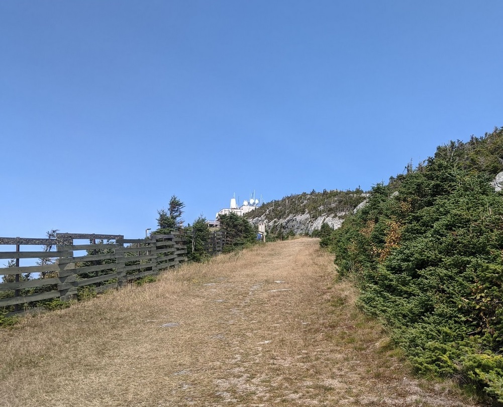
Sign Pointing to Lake Champlain
It may be easier to see the white dot from Emerald Point than it is to see Lake Champlain from Jay Peak. Below is a photo of a sign post on Jay Peak pointing to Lake Champlain. And you may even be able to see Lake Champlain in one or two photos. Perhaps it is easier to see the Adirondack Mountains in New York than to see the closer Lake Champlain. The Sky Haus Deli says it overlooks "scenic views of Vermont, New York, and Canada."
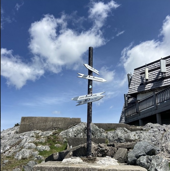
Jay Peak directions. Lake Champlain to the west. Photo by Isabelle Moisen, June 2022. |
| |
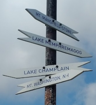
Jay Peak directions. Lake Champlain to the west. Photo by Lisa W, August 2018.
- Mt. Mansfield/Stowe - 30 miles south southwest
- Lake Memphremagog - 16 miles east
- Lake Champlain (Emerald Point) - 38 miles west southwest
- Lake Champlain (Swanton) - 29 miles west
- Mt. Washington, NH - 75 miles southeast
|
|
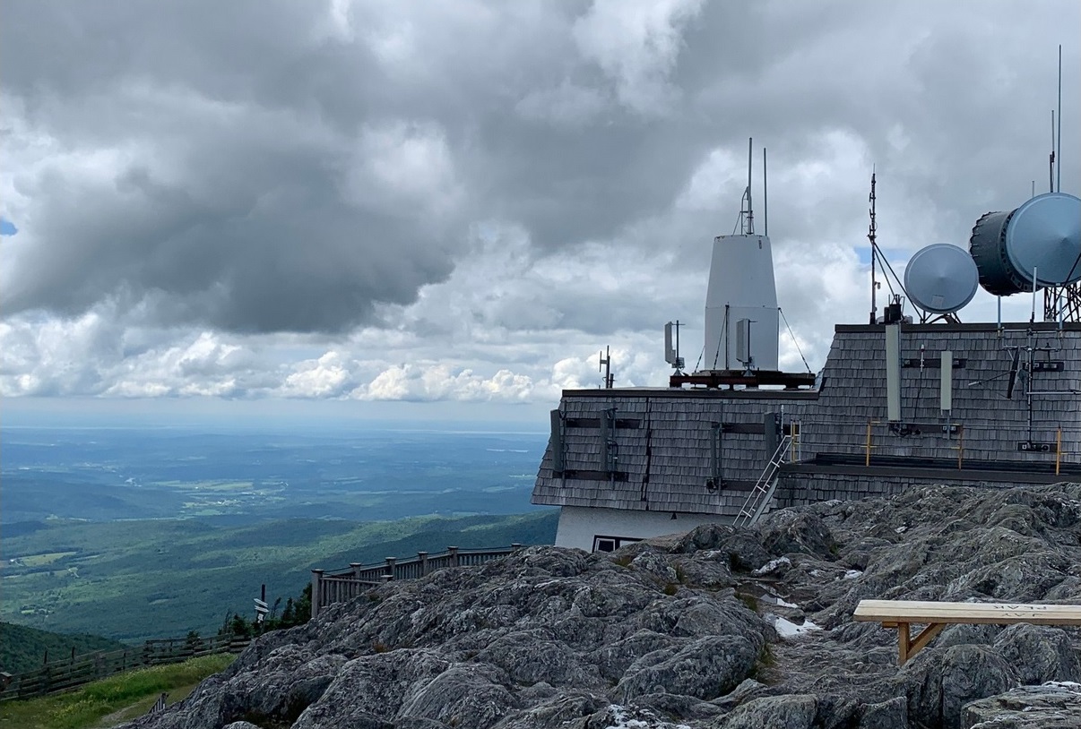
Westerly view from Jay Peak. Is that Lake Champlain and the Adirondacks in the distance? Photo by Karen Davidson, July 2020. |
Westerly view from Jay Peak. Is that Lake Champlain and the Adirondacks in the distance? |
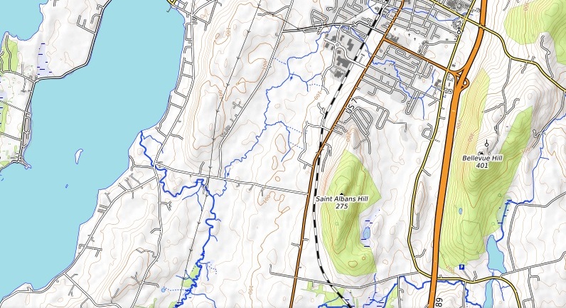
Other Mountains
In 2021, I started looking seriously into the mountains in the August 2018 photo. The focus was on five mountains, not just Jay Peak. I had not thought about the white dot and Bellevue Hill back then. And I did not have the Map Pedometer, showing the elevation along the line of vision.
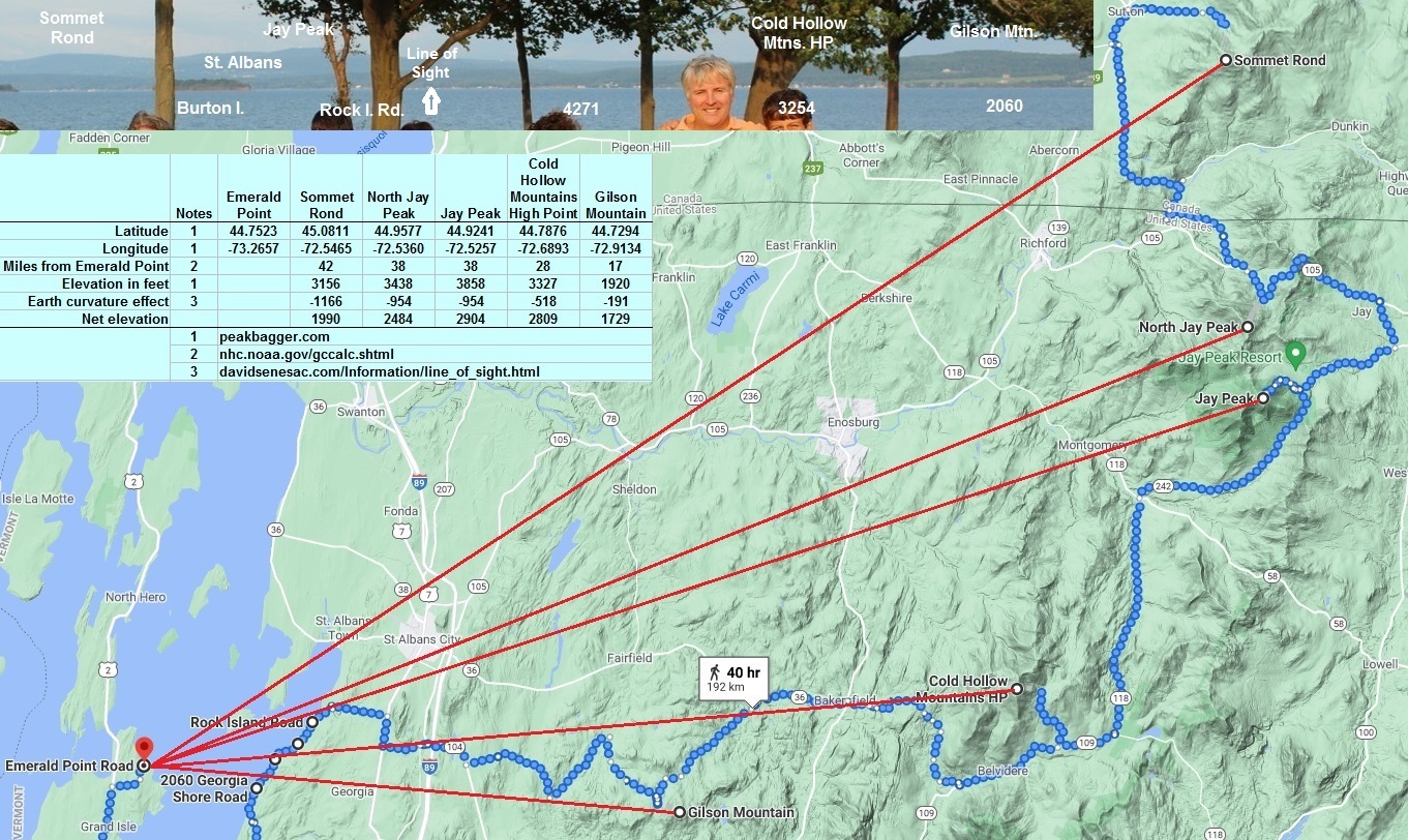
Analysis of mountain views from the northeast shore of Grand Isle, Vermont, including Jay Peak. October 2021. |
The following anlysis was done in August 2022, using the Map Pedometer. It shows that Jay Peak and North Jay peak cannot be seen from Emerald Point. This is especially true when you consider the curvature of the earth. See: Earth's Curvature
by David Senesac. But it should be possible to see the other three mountains.
Sommet Rond (Round Top) in Canada
Elevation and distance from Emerald Point on Grand Isle to Sommet Rond (Round Top) in Canada. See: Map Pedometer. |
North Jay Peak
Elevation and distance from Emerald Point on Grand Isle to North Jay Peak. See: Map Pedometer. |
Jay Peak
Elevation and distance from Emerald Point on Grand Isle to Jay Peak. See: Map Pedometer. |
Cold Hollow Mountains High Point
Elevation and distance from Emerald Point on Grand Isle to Cold Hollow Mountains High Point. See: Map Pedometer. |
Gilson Mountain
Elevation and distance from Emerald Point on Grand Isle to Gilson Mountain. See: Map Pedometer. |
|
 Jay Peak?